When it comes to GIS LiDAR analysis, having a well-defined scope of work is essential for a successful project. It sets the foundation for accurate data collection, processing, and analysis, ensuring that your team stays on track and delivers exceptional results.
ClickUp's GIS LiDAR Analysis Scope of Work Template simplifies the entire process, allowing you to:
- Clearly define project goals, objectives, and deliverables
- Establish a timeline with specific milestones and deadlines
- Outline the necessary data collection and processing methods
- Assign responsibilities to team members for seamless collaboration
With this template, you'll have everything you need to kickstart your GIS LiDAR analysis project and achieve outstanding outcomes. Get started today and take your analysis to new heights!
Benefits of GIS LiDAR Analysis Scope of Work Template
When it comes to GIS LiDAR analysis, having a clear scope of work is crucial for a successful project. With the GIS LiDAR Analysis Scope of Work Template, you can:
- Define project objectives and deliverables, ensuring everyone is on the same page
- Outline the specific tasks and activities required for accurate LiDAR analysis
- Set clear timelines and milestones, keeping the project on track
- Allocate resources effectively, ensuring the right expertise and equipment are available
- Provide a comprehensive overview of the project scope to stakeholders, fostering transparency and alignment
Main Elements of GIS LiDAR Analysis Scope of Work Template
ClickUp's GIS LiDAR Analysis Scope of Work template is designed to streamline your LiDAR analysis projects and ensure efficient collaboration. Here are the main elements of this Doc template:
- Custom Statuses: Track the progress of your LiDAR analysis project with custom statuses tailored to your workflow, such as Data Collection, Data Processing, Quality Control, and Final Delivery.
- Custom Fields: Utilize custom fields to capture important project details, including Project ID, LiDAR Sensor Type, Flight Date, Data Resolution, and more, ensuring all relevant information is easily accessible.
- Different Views: Access multiple views to visualize and manage your LiDAR analysis project effectively. Use the Table view to organize and filter project data, the Calendar view to track project milestones and deadlines, and the Gantt chart view to create a timeline and manage project dependencies.
With ClickUp's GIS LiDAR Analysis Scope of Work template, you can streamline your project management, enhance collaboration, and ensure the successful completion of your LiDAR analysis projects.
How to Use Scope of Work for GIS LiDAR Analysis
When using the GIS LiDAR Analysis Scope of Work Template, follow these 6 steps to ensure a smooth and efficient process:
1. Define project objectives
Start by clearly defining the objectives of your GIS LiDAR analysis project. Determine what you want to achieve, whether it's creating a detailed digital elevation model, identifying vegetation patterns, or analyzing flood risk areas. This step will help provide a clear direction for the project.
Use the Goals feature in ClickUp to outline and track your project objectives.
2. Gather project requirements
Next, gather all the necessary project requirements. This includes data specifications, such as point density and accuracy requirements, as well as any specific deliverables you need, such as contour maps or 3D models. Understanding the requirements upfront will help ensure that the scope of work is comprehensive and accurate.
Create custom fields in ClickUp to collect and organize all the project requirements.
3. Develop a detailed work plan
Based on the project objectives and requirements, develop a detailed work plan that outlines the tasks, milestones, and timelines for the GIS LiDAR analysis. Break down the project into manageable steps, such as data acquisition, preprocessing, classification, and analysis. This will help you stay organized and ensure that all aspects of the project are covered.
Use the Gantt chart feature in ClickUp to create a visual timeline and dependencies for your work plan.
4. Assign responsibilities
Assign responsibilities to team members for each task in the work plan. Identify who will be responsible for data collection, processing, analysis, and reporting. Clearly define roles and expectations to avoid any confusion or overlap.
Use tasks in ClickUp to assign responsibilities and track progress for each team member.
5. Monitor progress and make adjustments
Regularly monitor the progress of the GIS LiDAR analysis project and make any necessary adjustments along the way. Keep track of milestones and deadlines to ensure that the project stays on schedule. If any issues or challenges arise, address them promptly and adjust the work plan as needed.
Use the Dashboards feature in ClickUp to track project progress and visualize key metrics.
6. Review and finalize deliverables
Once the GIS LiDAR analysis is complete, review and finalize the deliverables. Ensure that all project objectives and requirements have been met. Conduct a thorough quality check to verify the accuracy and integrity of the analysis results. Make any necessary revisions before delivering the final work to the client or stakeholders.
Use the Docs feature in ClickUp to create a comprehensive report or presentation for the final deliverables.

Get Started with ClickUp's GIS LiDAR Analysis Scope of Work Template
GIS analysts and LiDAR specialists can use this GIS LiDAR Analysis Scope of Work Template to effectively plan and execute LiDAR analysis projects.
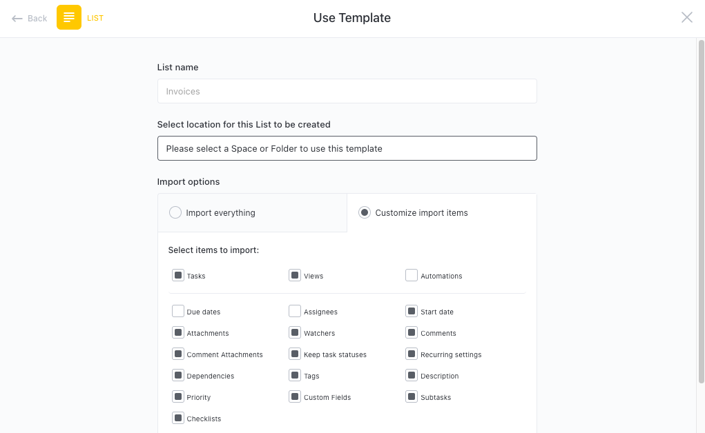
First, hit “Get Free Solution” to sign up for ClickUp and add the template to your Workspace. Make sure you designate which Space or location in your Workspace you’d like this template applied.
Next, invite relevant members or guests to your Workspace to start collaborating.
Now you can take advantage of the full potential of this template to conduct precise LiDAR analysis:
- Use the Gantt Chart view to create a detailed project timeline and allocate resources
- The Board view will help you organize and track all tasks related to the LiDAR analysis project
- Utilize the Recurring Tasks feature to automate repetitive tasks and improve efficiency
- Set up Automations to streamline common tasks and improve workflow
- Leverage the Calendar view to stay on top of important milestones and deadlines
- Use the Table view to get a high-level overview of all your project tasks and their status
- Create Dashboards to visualize and share project progress with stakeholders
- Collaborate with team members in real-time using the Docs feature to document important findings and insights
- Integrate with external tools and platforms to seamlessly transfer data and streamline your LiDAR analysis workflow
- Utilize the AI capabilities to analyze LiDAR data and generate actionable insights
- Monitor and analyze the workload view to ensure a balanced and efficient distribution of tasks.


